Track the impact of severe weather events with Polygons, now in Europe


Polygons coverage has been expanded to Europe
Severe weather events like hurricanes and tornadoes cover more than just a single point on a map. That’s why we created Polygons, a feature that accurately identifies the geographic area impacted by severe weather events. We launched Polygons in the United States in late 2021 and now this feature is available for our severe weather event category in Europe! Access Polygons within the Control Center or via our events API.
Accurate insight into severe weather helps retailers including quick serve restaurants avoid major issues. Depending on the location of your supply chain routes, an incoming storm may be a minor inconvenience, or a business-critical problem that requires immediate attention to re-route suppliers.
PredictHQ tracks events across 34 different countries across Europe, and the often destructive and inconsistent path of severe weather events crosses borders without bias. For example, there’s a moderate flood warning that covers France but also spills east into Switzerland and south into Spain:
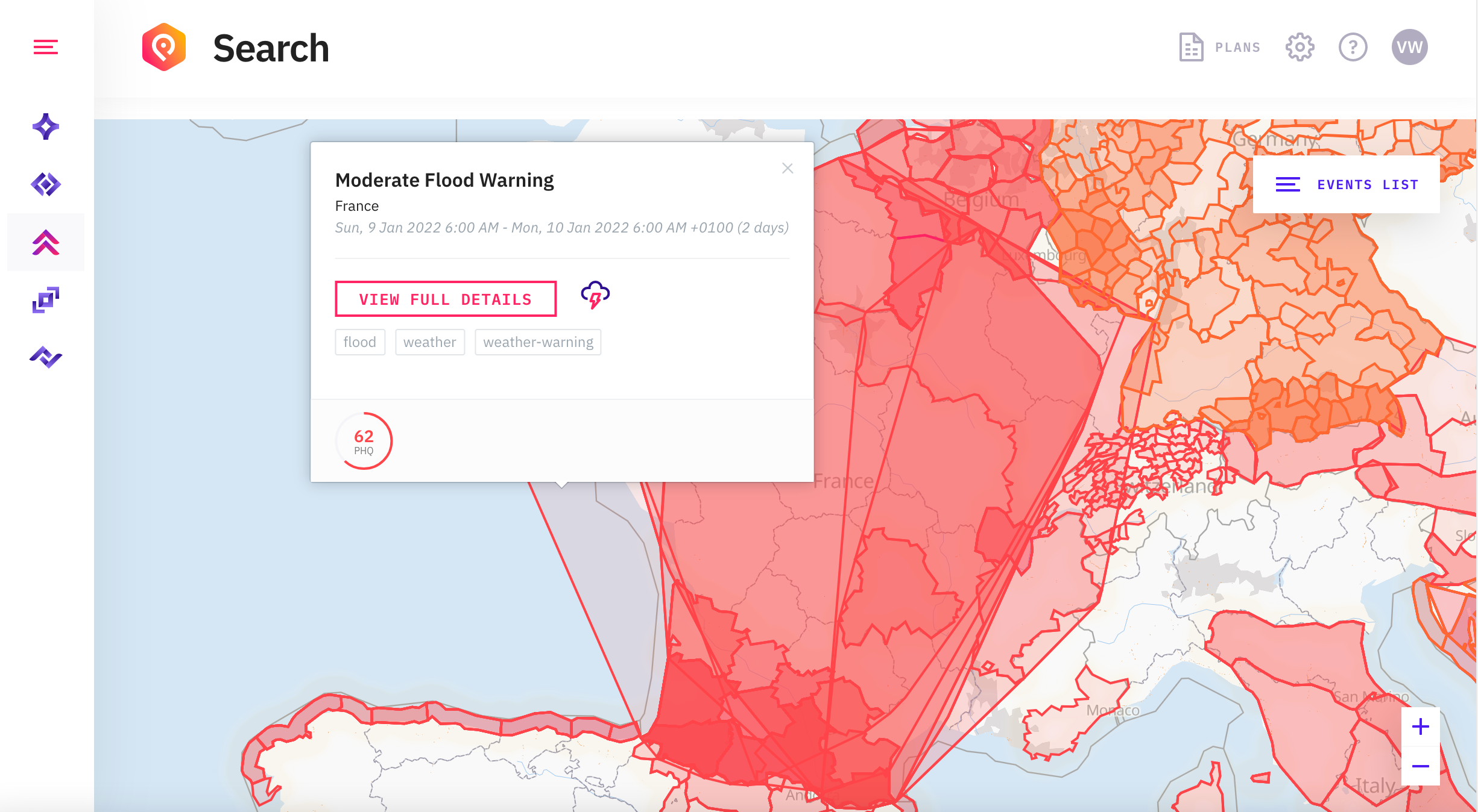
If you were searching for severe weather events in France, you may not realize an incoming event will be impacting locations in bordering countries also. In the same way, a flood can severely impact one store in a suburb, while other locations remain unscathed. For companies with locations across multiple countries, Polygons can be useful to visualize the impact of severe weather for different regions and territories at a glance.
Get Polygon information via Control Center or API
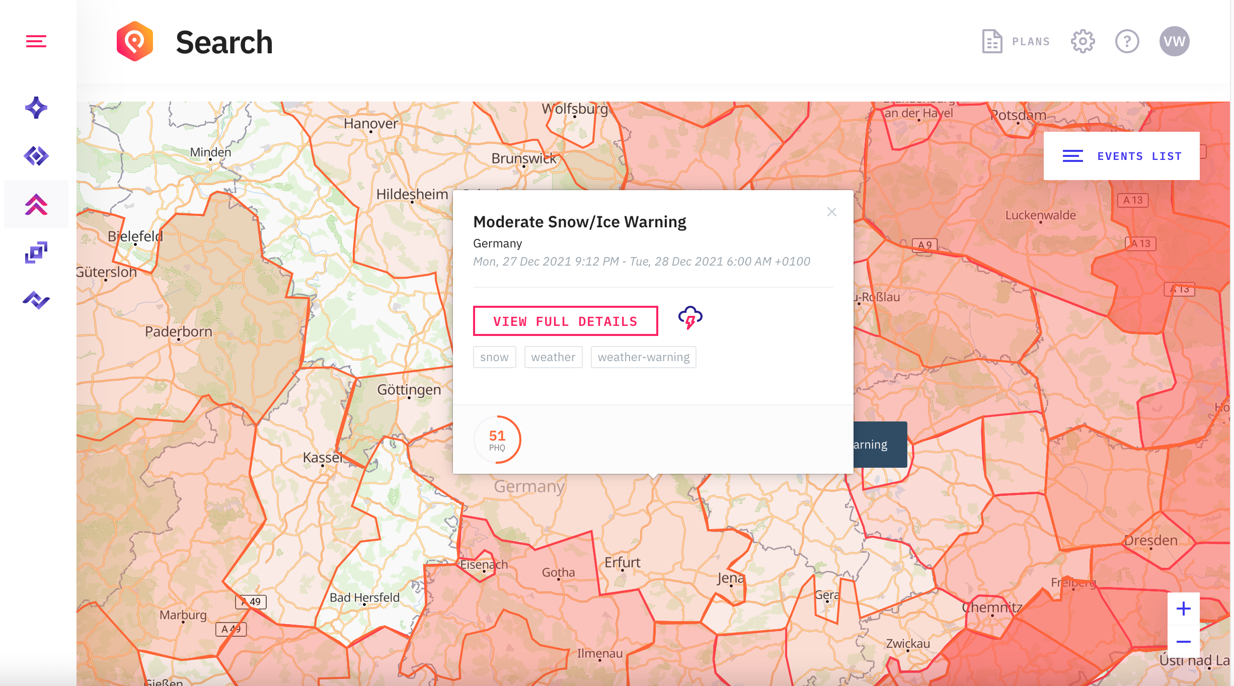
Within the PredictHQ Control Center, you can see Polygons in the map view. When searching for events within a certain radius, your results will display all Polygons that overlap that area. Visualize all impacted areas near your business locations to better understand which ones will be impacted, and to what degree.
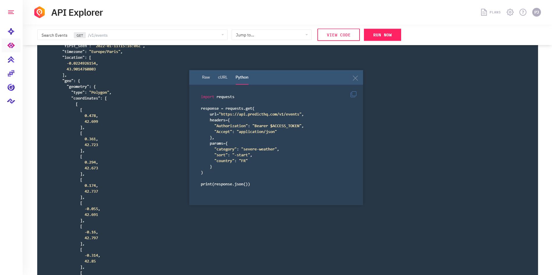
Polygon information is also available via the events API. Searching via the API uses the underlying polygon data to find events impacting a location. You can open individual events for more details about the area impacted by each severe weather event.
Polygon information is returned in the API on the geo field. See below for an example of how to use API explorer in the Control Center to search for recent severe weather in France. The event shown is a flood event. You can see the polygon info in the geo field as a list of latitude and longitude coordinates for the points of the polygon. This is in GeoJSON format.
When you use the within filter or the scope filter, the API will return events with overlapping polygons. We do the work for you of finding events that impact your geographic area.
Easily identify severe weather events impacting your European locations
By being able to track the geographical area impacted by an event rather than just by location, lat/long, or country, you can more accurately understand the total area affected. Along with coverage in the United States, PredictHQ now supports Polygons in the following countries:
Austria
Belgium
Bosnia-Herzegovina
Bulgaria
Croatia
Cyprus
Czech Republic
Denmark
Estonia
Finland
France
Germany
Greece
Hungary
Iceland
Ireland
Italy
Latvia
Luxemburg
Malta
Montenegro
Netherlands
North Macedonia
Norway
Poland
Portugal
Romania
Serbia
Slovakia
Slovenia
Spain
Switzerland
Sweden
United Kingdom
Get started now to view polygons in the Control Center or access them via the API.


